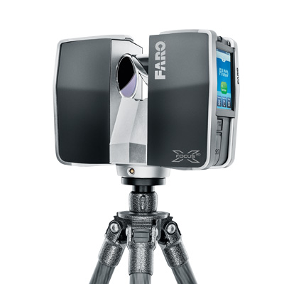
3D Scanner - FARO Focus
FARO Focus Model
This model belongs to the family of terrestrial laser scanners. It has a GPS sensor to accurately position the 3D scans. It produces dense point clouds containing millions of points that provide extremely accurate and rich 3D images of large structure geometries (up to 130 m).
Features :
- Technology : phase shift laser
- Export formats : XYZ, XYZRGB
- Max. accuracy 2 mm
- Acquisition speed : 976000 points/s
- Camera resolution : 70 MP
- Working distance : 0.6 - 130 m
- Dimensions 240 × 200 × 100 mm
- Weight : 5.2 kg
- Power supply : 40 - 80W
- OS Compatibility : Microsoft Windows
- Software : SCENE
Applications : Perform fast and accurate 3D surveys indoors and outdoors. 3D scanning of buildings and complex structures.


